 BPN-TRACK
Map tools and the map type
Change the map, show names, trails and geofences, measure a distance or find what is near.
How to
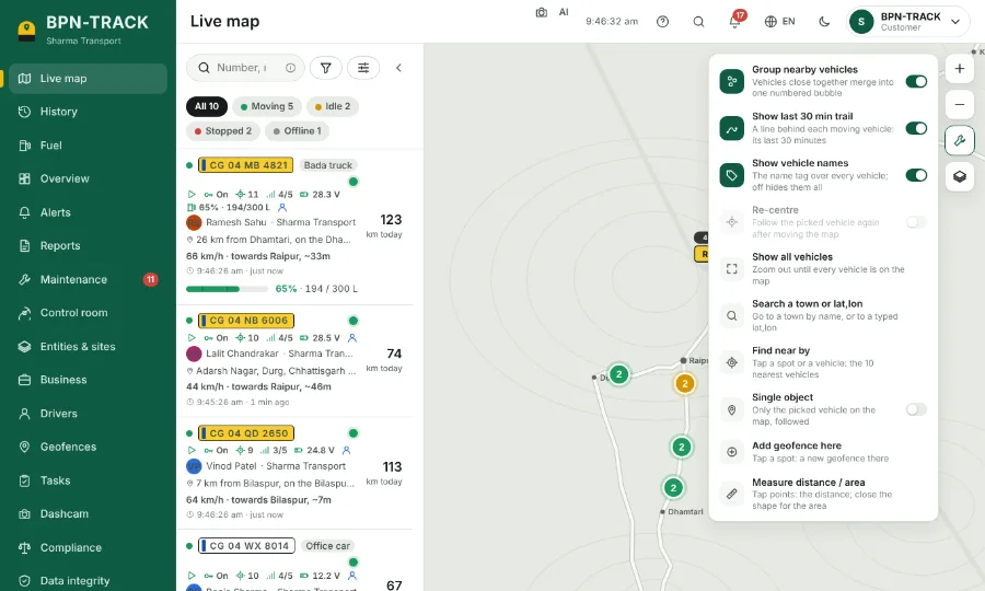
- On the Live map, the buttons on the right are zoom in, zoom out, Tools (the wrench) and the map type (the layers).
- The map type button: choose Open Map, Google Map, Satellite or Hybrid, and tick Show geofences or Live traffic.
- "Open the Live map here next time" keeps the place and zoom you are looking at for your next visit.
- Tools: Group nearby vehicles, Show last 30 min trail, Show vehicle names, Show all vehicles and Single object (only the picked vehicle, followed).
- Also under Tools: Search a town or lat,lon, Find near by (the vehicles nearest to a spot), Add geofence here and Measure distance / area.
- Your choices are kept with your login, on every device.